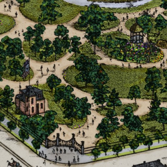
Compton & Dry in Color: Plate 39

It continues to be my favorite “thing” in St. Louis history. A map often referred to simply as “Compton and Dry” after the man who published it (Richard Compton) and the guy who drew it (Camille Dry), the map’s official name is Pictorial St. Louis, the Great Metropolis of the Mississippi valley; A Topographical Survey Drawn…

Adding a Bit of Color to St. Louis History

In recent months, I’ve noticed a trend in the world of digital photography that I think is pretty neat. In various blogs, social media feeds, and Internet articles, folks have been posting colorized versions of historic black and white photographs. Try googling something like “Civil War in color”, and you’ll find scores of Rebs in…

The Great Cyclone of 1896

In the late afternoon of May 27, 1896,  a meteorologist by the name of Irl Hicks looked out the window of his observatory on 22nd street in St. Louis. He watched anxiously as black clouds and green skies loomed dangerously to the south.  An ordained minister, Confederate veteran, and publisher of his own almanac, Hicks…